|
|
|
|
|
 |
 |
Featured Applications |
|
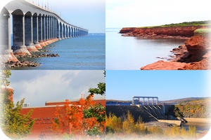
See how GNT contributes its technology to high precision GNSS business and markets. |
|
|
|
|
■
■
■ |
A real-time GNSS deformation monitoring software, processing single-frequency baseline data from single- or dual-frequency GNSS receivers and delivering up to millimetre level accuracy. Especially designed to deal with budget-sensitive projects.
A real-time GNSS deformation monitoring software, processing mixed baselines from both single-frequency GNSS receivers monitoring the deformation of objects and dual-frequency GNSS receivers monitoring the stability of the reference stations.
mmVu® PP is a group of powerful GNSS deformation monitoring post-processing software, including mmVu® LabCue, mmVu® LabTime and mmVu® LabSync. A unique, efficient GNSS data processing strategy, enabling customers to reproduce the real-time GNSS environments where the GNSS stations' data were collected. |
■
|
mmVu® Landslide Synergizer is a real-time, landslide or unstable slope monitoring system package, processing single-frequency monitored GNSS baselines and controlling the stability of a reference station by processing dual-frequency GNSS baselines simultaneously. |
|
|
|
||||
|
■
■ |
Long-range offshore GNSS positioning: Innovative GNSS technology and long range data link provides very high accuracy on high seas.
Building deformation monitoring: High precision GNSS technology reveals short-term and long-term deformations of buildings. |
|||
|
|
 |
||
|
■
■
■
■ |
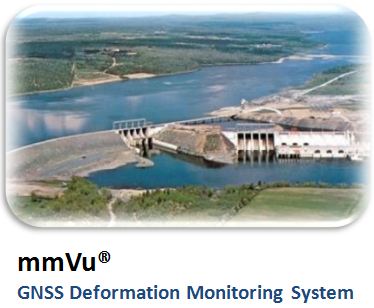
mmVu® GNSS deformation monitoring system has been installed at Shuibuya dam located in Qingjiang River, Badong County, Enshi, Hubei Province, China.The Shuibuya dam is the tallest concrete face rock-fill embankment dam in the world at 233 m tall. [more]
mmVu® Synergizer taps into the Canadian Active Control System (CACS) and demonstrates static positioning precision at the mm level in each of the three-dimensional components for distances up to 400 km. [more]
GNT undertakes a two-year R&D project associated with base system infrastructure and rover system to be used for real-time, high-precision maritime positioning and navigation applications. [more]
GNT receives the Canada Dam Association (CDA) Published Paper Award of Excellence at the 2012 CDA Awards ceremony. Recognized for the paper "A Study of the Use of GPS Sensors for Structural Monitoring of the Mactaquac Dam." [more]
|
||
© 2013 Gemini Navsoft Technologies Inc. - All rights reserved. |
This website is optimized for Google Chrome, Mozilla Firefox and Apple Safari.